
Earthquake Near Me: How to Check the Latest USGS Earthquake Map
Find recent earthquakes on the USGS map, check the event time and location, and understand why your map filters may hide a nearby tremor.

Contents9
- How to find an earthquake near you on the USGS map
- Which earthquake details should you check first?
- Why might a nearby earthquake be missing?
- Does a Google search spike confirm an earthquake?
- What is the difference between magnitude and shaking intensity?
- Is the USGS map an earthquake warning or prediction?
- What should you do if the ground is shaking now?
- How should you share a nearby earthquake update?
- Can you find yesterday's earthquake on the same map?
To check an earthquake near you, open the USGS Latest Earthquakes map, find your area, and compare the event time with when you felt the shaking. Select an event to see its details rather than relying on a search-result headline or an image shared on social media.
The useful question is not simply whether an earthquake appears somewhere on a map. It is whether its location and timing match your experience. A distant event, an old screenshot, or a timestamp in another time zone can make an unrelated earthquake look relevant.
How to find an earthquake near you on the USGS map
To find a nearby earthquake on the USGS map, open the official map and adjust the area, time window and magnitude settings before selecting an event.
USGS describes the tool as a real-time and near-real-time display, with adjustable settings and links from individual events to detailed information. Its standard coverage includes magnitude 2.5 and above in the United States and magnitude 4.5 and above worldwide. Those thresholds describe the display; they do not mean smaller earthquakes never occur.
Use this sequence to avoid matching the wrong event:
Open the official Latest Earthquakes map, rather than a reposted image.
Move to your region and check the selected time window.
Review the magnitude filter if you cannot see a small event.
Select a map marker or list entry and read the event page.
Compare the event time and location with your own notes.
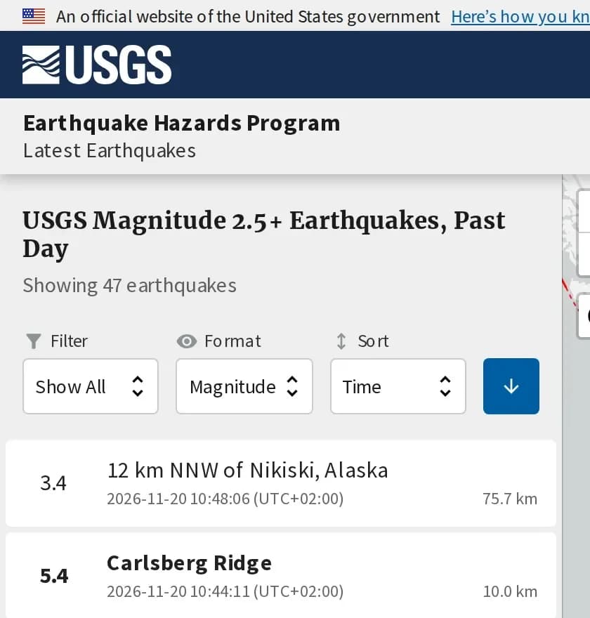
The USGS event-list view below shows the magnitude and time filters beside individual earthquake records; use those controls before matching a tremor to your location.
Which earthquake details should you check first?
The first details to check on a USGS earthquake record are its date, time, location, magnitude and depth. Read them together; one number alone cannot establish that you felt that particular event.
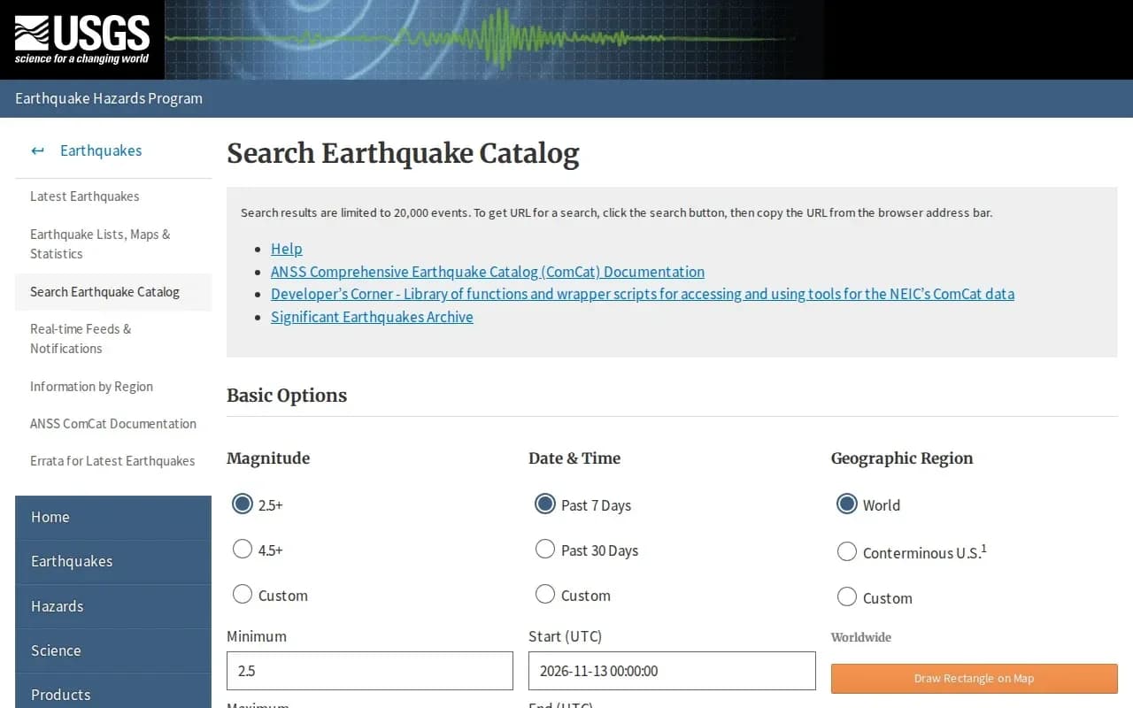
The USGS Earthquake Catalog lets you search by date, magnitude and area. Its date fields use UTC. If you compare a UTC record with a local clock, convert the time before deciding whether the event matches. For example, 10:00 UTC and 10:00 local time need not describe the same moment.
Keep the link to the individual record if you share it. A link preserves context more effectively than a cropped map with no date or location scale.
The catalog form below separates magnitude, dates and location, making it easier to search for an older event instead of relying on a reposted map.
Why might a nearby earthquake be missing?
A nearby earthquake may be absent from your current USGS view because the map area, time window or magnitude filter excludes it. Check those settings before concluding that no event occurred.
If you need an older event, use the catalog instead of repeatedly refreshing the latest-events view. If the interactive map does not load, the USGS map page also links to earthquake feeds that can be read without its interactive display.
Does a Google search spike confirm an earthquake?
A spike in searches for "earthquake near me" does not confirm the location, size or impact of an earthquake. Search interest describes what people are looking for; the event record is where you check the earthquake itself.
For a useful update, share the official event link and its timestamp. Keep reports of damage or disruption separate and attribute them to the relevant local authorities. That distinction makes a short message much more reliable than an alarming headline without a source.
What is the difference between magnitude and shaking intensity?
Magnitude describes an earthquake's size, while intensity describes shaking at a particular location. USGS distinguishes the event's overall magnitude from the experience reported in different places. Two people can experience the same earthquake differently without either account being wrong.
For example, someone searching from one neighborhood may report a brief movement while another person reports stronger shaking elsewhere. Their reports should not be used to invent two magnitudes for the same event. Compare the event record first, then look at information about local shaking.
These fields answer different questions when you read a map entry:
Field | Question it answers | Common mistake |
|---|---|---|
Magnitude | How large was the earthquake? | Treating it as a description of every person's experience |
Location | Where was the event located? | Assuming the named nearest place is the only affected area |
Depth | How far below the surface was the source? | Confusing depth with distance from your home |
Time | When did the event happen? | Comparing UTC directly with a local clock |
Reading the complete entry helps you keep each measurement in its proper role. It also prevents a dramatic number from becoming a claim about damage that the record does not establish.
Is the USGS map an earthquake warning or prediction?
The latest-earthquakes map is an event-information tool, not a promise to warn you before shaking or predict the next earthquake. USGS explains that early warning systems detect an earthquake after it begins; they may provide advance notice of shaking reaching another location.
That differs from prediction, which would specify a future earthquake's time, location and magnitude. A map showing recent activity does not provide those three things for a future event. Do not read an empty map as proof that shaking cannot happen, or a crowded map as a precise countdown.
Separate the tools by the task you need to complete: use an event map to investigate what happened, a properly configured warning service for available alerts, and local emergency communications for instructions affecting your area. One screen cannot replace all three functions.
What should you do if the ground is shaking now?
If shaking is happening now, protect yourself before opening an earthquake map. CDC guidance generally recommends dropping to your hands and knees, covering your head and neck under sturdy furniture where possible, and holding on until the shaking stops.
CDC also advises people already indoors to remain indoors during shaking and people outdoors to remain outdoors. Once you are safe, check current local instructions rather than assuming a social-media post applies to your building or neighborhood. Looking up the magnitude can wait; protection from falling objects cannot.
How should you share a nearby earthquake update?
A useful nearby-earthquake update includes the event link, location, date and correctly labeled time, while keeping personal observations separate from official measurements.
Before sending an update to family or a group chat, make a quick accuracy check:
Match the date: a convincing map screenshot may show a previous event.
Name the time zone: write UTC or the relevant local zone.
Keep the location: do not crop away the map scale or event title.
Distinguish observation: "I felt shaking" is different from a confirmed damage report.
Avoid prediction claims: recent tremors do not establish an exact future earthquake.
If the event details are later updated, sharing the record link lets recipients see the current information. A copied number without context is much harder to correct after it spreads.
Can you find yesterday's earthquake on the same map?
You can investigate an older nearby earthquake by changing the time window or searching the earthquake catalog. Use the date of the event, not the date when someone reposted a story about it.
For a recurring question, bookmark the official tool itself instead of saving one frozen screenshot. That gives you a repeatable way to check the next report without relying on search rankings or whichever social post happens to appear first.
Best of the week — in your inbox
No spam. Only top Gosta stories. Unsubscribe in one click.
Comments